


Archaeological survey


Orkney is renouned for its variety and wealth of archaeological sites on land, however those beneath the surface are less well documented. SULA staff have been involved in the research and development of remote sensing techniques for the rapid mapping of seabed biotypes. These techniques can equally be applied to the rapid mapping of archaeological sites.
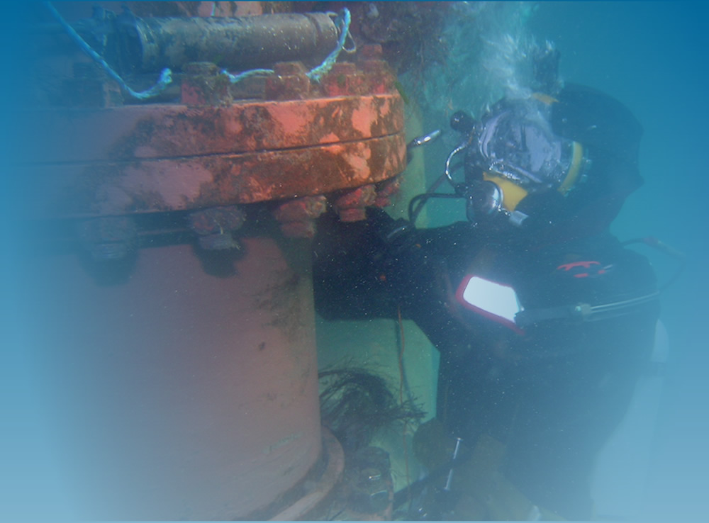
In 2000, staff conducted a high resolution 3D mapping programme of the remaining vessel of the scuttled German High Seas Fleet in association with the Archaeological Diving Unit (then based at St Andrews University), RESON Ltd and the Center for Coastal & Ocean Mapping at the University of New Hampshire.
SULA has been involved with numerous projects over the years, working closely with Orkney Research Centre of Archaeology (ORCA), Historic Environment Scotland (HES) and Nautical Archeaology Society. Many of these projects can be found on the scapaflowwrecks.com website.
Sula is currently working on several new projects with the desk based research and fieldwork still underway.


Contact
Malcolm Thomson
Janitor’s Flat, Old Academy
Back Road, Stromness
Orkney KW16 3AW
Tel: +44 1856 850285
Fax: +44 7761729850
Email: This email address is being protected from spambots. You need JavaScript enabled to view it.
Orkney Weather
Stromness Tide Times
Stromness Tide Times for 25th April 2024
Tide Times & Heights for Stromness on 25th April 202404:30 - Low Tide (0.75m)10:41 - High Tide (3.29m)16:50 - Low Tide (0.69m)22:58 - High Tide (3.26m)